Shanghai Is Digging a New River – and It Will Cost 55 Billion Yuan
When Typhoon Dolphin slammed Shanghai with record-breaking rain in August, one of the world's biggest cities confronted a familiar problem: There was simply too much water, and nowhere for it to go.
In Xujiahui, 316.1 millimeters of rain fell in just 24 hours, shattering a rainfall record that had stood for more than 150 years. Downtown Shanghai issued its first red rainstorm alert in 13 years.
In Songjiang District, a swollen river backed up into a gated villa community. Across the city, crews worked through the night, pumping water from flooded residential compounds, roads and underpasses.
Then, on August 10, Shanghai resorted to a measure it had never used before. The city deployed 15 giant mobile pumps to push water out of Suzhou Creek and into the Huangpu River, trying to keep the overflowing waterway from spilling into downtown streets.
Since 2020, Shanghai has been quietly building what is now its largest single water infrastructure project ever: the Wusongjiang River Project.
The 55-billion-yuan (US$7.6 billion) effort will carve a new flood channel from neighboring Jiangsu Province to the East China Sea.
"The Taihu Lake basin cannot afford to flood," said Sun Yonglin, chief engineer at the Shanghai Survey and Design Research Institute under China Three Gorges Corp, which designed the Shanghai section of the project.
"Once a large-scale flood hits, the impact is huge," he added.
A city built by moving rivers
Shanghai's struggle with water management is nearly as old as the city itself.
The Huangpu River, which is now the most recognized waterway associated with Shanghai, was not the city's original main channel.
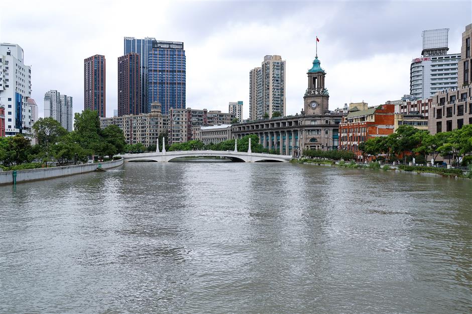
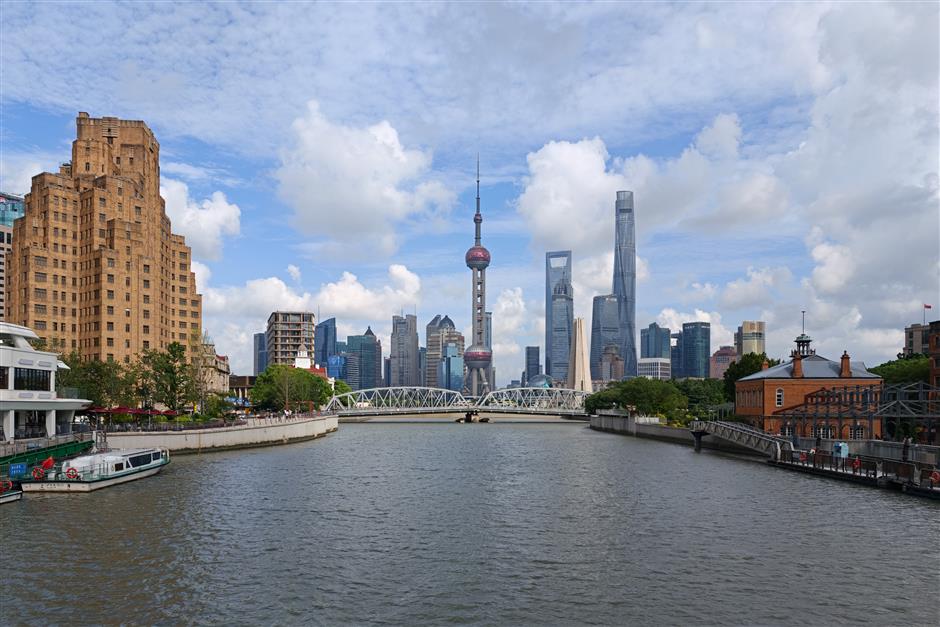
That distinction once belonged to the Wusong River, known today as Suzhou Creek, a waterway with a history dating back approximately 2,000 years.
By the early 1400s, the Wusong River had become severely silted, leading to repeated flooding in the surrounding area.
In 1403, a local official named Ye Zongxing proposed a radical solution: cease efforts to dredge the clogged Wusong River.
Instead, he suggested widening and deepening a smaller channel called Fanjiabang, which would connect it to the Huangpu River, allowing floodwater to flow out to sea via a different route.
The plan proved successful. Water that had previously flowed through the Wusong River began to flow through the Huangpu instead. Local histories refer to this event as "the Huangpu taking over from the Wusong."
Suzhou Creek, once the region's main artery, became a tributary. The wider, steadier Huangpu eventually made Shanghai's growth as a port city possible.
Six centuries later, Shanghai is once again rerouting water to survive – this time by adding a third route entirely.
The bottom of a bowl
Shanghai sits at the low end of the Taihu Lake drainage basin. The basin spans Jiangsu and Zhejiang provinces and Shanghai.
Experts describe it as bowl-shaped: high around the rim, low in the middle. Rain from the surrounding hills drains toward the lake.
The challenging aspect is extracting that water. Taihu Lake has no direct outlet to the Yangtze River. Floodwater must be pushed out through a handful of narrow channels.
Two channels do most of the work today. The Wangyu River carries water north from Wuxi to the Yangtze.
The Taipu River carries it east, through Shanghai's Qingpu District and into the Huangpu River, before it reaches the Yangtze.
A third route to the sea
The Wusongjiang project adds a third eastern outlet. It is meant to ease pressure on the aging Huangpu route.
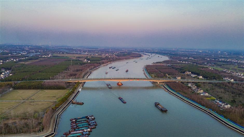
The full waterway runs 126 kilometers, from eastern Taihu Lake across Jiangsu into Shanghai. The 69-kilometer Shanghai section passes through the Qingpu, Jiading and Baoshan districts.
Near the Jiading-Baoshan border, it splits into two branches. One flows north through the Luoyun and Xinchuansha rivers to the Yangtze River. The other continues east into the lower reaches of the Huangpu River.
"Once the Wusongjiang project is in place, floodwater from the basin will have new outlets to the Huangpu and the Yangtze," said Zheng Hailong, deputy director of the comprehensive planning division at the Shanghai Water Authority.
"It won't all have to go through Suzhou Creek anymore."
Existing waterways, some barely 20 meters wide, are being widened to 96-120 meters. Thirty-four bridges along the route need to be rebuilt with longer spans to fit the wider channels.
One bridge alone will span 208 meters.
Twenty centimeters that matter
The most immediate beneficiaries are Jiading and Baoshan. The low-lying districts in Shanghai's north have long lacked a major trunk channel of their own for draining storm water.
Engineers can lower water levels by 20 centimeters during extreme storms after the project is finished. It should drain 15 million cubic meters more water daily.
A new Xinchuansha River pumping station will do much of that. It can fill an Olympic-size pool in 20 seconds with 150 cubic meters of water per second.
"Jiading and Baoshan have always lacked a major channel for draining floodwater to the river," Sun said. "This waterway gives the whole area a way out."
Parts of the project are already working. About 34.2 kilometers of the new channel are under construction. The Xinchuansha River section is largely finished. During Typhoon Dolphin, sections of Jiading that had flooded in past storms stayed dry, according to the project designers.
The project is due to be finished by 2030. The goal is for the waterway to be basically connected end to end by then, so floodwater from upstream can flow through freely.
Before that, Shanghai's defense against the next typhoon still rests on the same emergency crews who spent seven days and six nights this past August clearing more than 180 flooded spots across the city – one pump, one street, one flooded compound at a time.
Editor: Liu Qi
In Case You Missed It...

 Sep 15, 2026
![[Weekend Escape] Yellow Mountain & Its Surrounding Villages](https://obj.shine.cn/files/2026/09/11/a43116a9-f87d-405f-a1b7-5fc3d3a3aa1a_0.jpg)