[Only in SH] Shanghai's Streets Are Actually A Map of China – Here's Why
Editor's Note
Everyone knows the Bund. Fewer people know the sound of mahjong echoing through a Shanghai lane at dusk.
This Only In SH series explores the side of Shanghai that often escapes travel guides – the old alleyways, neighborhood eateries, fading shop signs, strange local habits, forgotten stories and everyday rituals that continue to shape the city beneath its modern image.
Why do local Shanghainese refer to roads as "Malu," which translates to "horse roads," and why are so many streets named after places in China?
The explanation lies in the history of horses, a racecourse, and a naming compromise that subtly transformed Shanghai's streets into a representation of China.
From "Park Lane" to "Malu"
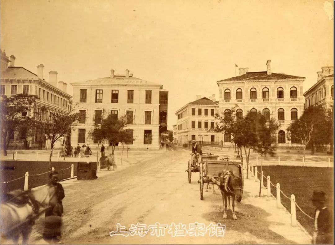
Shanghai's first urban road was near a racecourse during the British settlement period. As horses were a common sight on the road, locals called it "Malu," or "horse road." Its English name was "Park Lane."
The Shanghainese called this road Damalu, meaning "big road." It is today known as Nanjing Road.
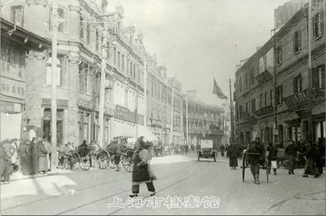
People named the parallel east-west roads to its south in the easiest way: Second, Third, Fourth, and Fifth Malu. They are now known as Jiujiang, Hankou, Fuzhou, and Guangdong roads.
When Road Names Were a Mess
Some roads were named after nearby landmarks or functions. A road near a temple became "Temple Road." One near a church became "Church Road." A road by the customs house became "Customs House Road," today's Hankou Road.
This informal system caused little trouble. The settlement was still small, and people could more or less figure things out.
But as the city expanded and commerce grew, it became confusing. One road could have several names, while the same name might be used for different roads. That was inconvenient for a fast-paced business city.
![[Only in SH] Shanghai's Streets Are Actually A Map of China – Here's Why](https://obj.shine.cn/files/2026/05/25/61067fc6-cf62-4f57-85d6-1f8a0104f5a3_0.jpg)
The Naming Compromise That Changed Shanghai
In 1863, the settlement authorities held a meeting to reorganize road names.
The British and American sides disagreed on naming styles. Then a compromise was proposed: use Chinese administrative place names.
It was simple and easy to remember.
North-south routes were named after provinces: Sichuan, Jiangxi, Henan, Shandong, Shanxi, Fujian, Hubei, Zhejiang, Guizhou, Yunnan, and Xizang.
East-west roads were named after cities like Nanjing, Jiujiang, Hankou, Fuzhou, Beihai, and Shantou.
That is why a walk through central Shanghai can feel like crossing a mini map of China.
![[Only in SH] Shanghai's Streets Are Actually A Map of China – Here's Why](https://obj.shine.cn/files/2026/05/25/5551ac98-f906-4cd3-ae31-3fdfbe7c4449_0.jpg)
The Small Mistake Hidden in Guangdong Road
There is one small exception, however.
Guangdong Road should have been named after a city, despite being a province.
The explanation lies in the English name "Canton Road." The southern trading port of Guangzhou was called "Canton" by European traders in the 19th century. It became Guangdong Road instead of Guangzhou Road when translated into Chinese.
In other words, one of Shanghai's familiar road names carries a small historical misunderstanding.
![[Only in SH] Shanghai's Streets Are Actually A Map of China – Here's Why](https://obj.shine.cn/files/2026/05/25/aad49f50-70a9-4bc5-b55f-99602c7c9eae_0.jpg)
Why These Names Stayed
As administrations change, many cities rename streets, but Shanghai's downtown road names were exceptionally steady.
Because administrative place names carried less political meaning, they were less likely to be changed with each historical shift. Over time, they became part of the city's daily language and memory.
That stability is part of their charm. Nanjing Road goes beyond retail. Hankou Road is more than a map line. Fuzhou Road has more than old bookstores and cultural institutes.
These names show how Shanghai evolved from a treaty port to a contemporary metropolis, with history on every street sign.
Next time you walk along Nanjing Road, Hankou Road, or Guangdong Road, look at the name a little longer.
In Shanghai, even asking for directions can lead you into the city's past.
![[Only in SH] Shanghai's Streets Are Actually A Map of China – Here's Why](https://obj.shine.cn/files/2026/05/25/e4de3e6a-59fb-472c-a06c-858b6f798d45_0.jpg)
Editor: Fu Rong
In Case You Missed It...
 Sep 20, 2026
![[SH Transit] Shanghai Speeds Up Work On Five New High-Speed Rail Stations](https://obj.shine.cn/files/2026/09/18/e4351051-0478-4845-88fe-8ca3b4c41ef7_0.jpg)